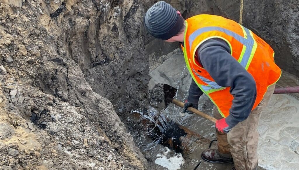
Have you experienced water loss? Do you have a spike in your water bill? Many of our waterlines are over 200 years old, and our existing infrastructure requires extensive updates due to water loss. GPRS provides leak detection services to pinpoint these water leaks and provide private utility locating to all types of projects. The following project took place in December 2021 at a large auto manufacturing facility. They showed water loss for 11 months and had jockey pumps running continuously to keep the pressure up.
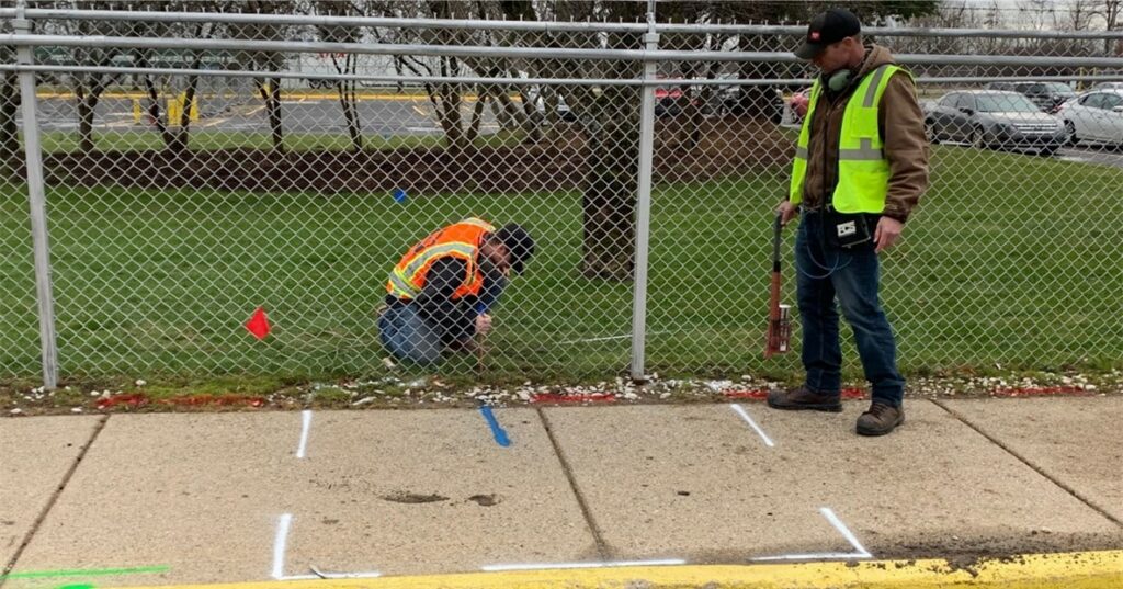
The client contacted GPRS after another company failed to pinpoint the leak. The facility’s perimeter stretched over 2 miles across truck docks, green space, and parking lots. We used noise amplification headphones (S30) to listen in on every hydrant and post indicator valve (PIV) around the perimeter and any valves or piping. Once we surveyed all the hydrants and PIVs, we concluded that two hydrants near the facility’s front had the most noise and showed signs of leaking. Furthermore, a nearby storm catch basin was constantly flowing and smelled of chlorine, indicating where the leaky water was flowing. Rough estimates put this water loss at one gallon per second. To pinpoint the leak, we used a leak noise correlator. The length between the hydrants was 330 feet, and after running a correlation, we identified the leak to 155 feet away from the hydrant. Establishing the leak’s location is half the battle, but how do you find the other utilities in the area to not have a utility strike while repairing the water leak? By using GPR and EM technologies, we were able to mark out the waterline and other utilities found near the leak. All findings were conveyed and marked on the surface with paint. Our client was thrilled we could locate the leak as he had been trying to repair this leak for close to a year!
Our industry-leading Subsurface Investigation Methodology or SIM process ensures that we do quality work on each job site. The GPRS Project Manager fully leverages the equipment in a systematic approach to locate as accurately as possible. The client minimizes surprises and damages from their underground work by calling GPRS.
Additionally, this client has requested mapping, which is particularly helpful when they aren’t on-site to discuss the findings. We offer two main utility maps, both collected with the same sub-meter GPS units. The first is a PDF document where the results are overlaid over aerial imagery of the scan area. Alternatively, we offer CAD maps of our findings as a second option. CAD maps are primarily beneficial when the client can provide a base map of the area, including driveways, sidewalks, and other known surface structures.
Every job includes a Job Summary Report, a typed summary of the job scope, and our findings. This is an excellent way for clients to show that they’ve taken all the necessary steps to have a safe workplace by calling in an expert to locate underground utilities.
When you have water loss or any infrastructure project, contact GPRS to ensure that you have a safe and efficient project. For questions about our process and capabilities, feel free to reach out to LeakDetectionInfo@gprsinc.com.